Overview
Teaching: 10 min Exercises: 5 minQuestions
What is masking and how can it be used to analyze portions of a dataset
Objectives
Learn the concepts of masking with xarray.
Masking with where:
So far we have used indexing to return subsets of the original. The subset array shape will be different from the original. However, we often want to retain the array shape and mask out some observations. There are applications here in remote sensing, land cover modeling, etc.
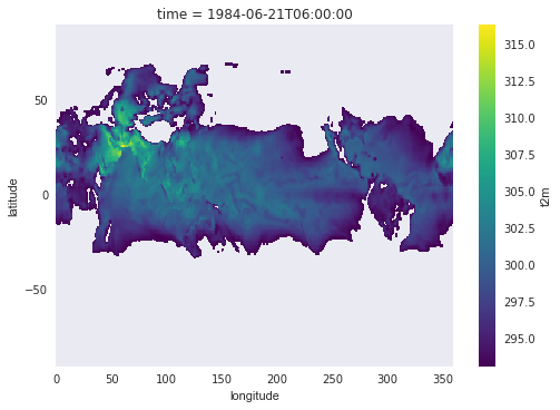
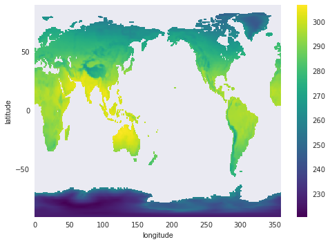
Suppose we need to determine which grid cells had temperatures > 20 deg C on June 21, 1984? We will use where() for this selection:
ds.sel(time="1984-06-21")['t2m'].where(ds.t2m > 293.15).plot()
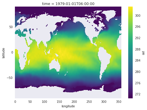
Another common Earth science application is to create land cover masks. Let’s use the sea surface temperature field (sst) to build a land and ocean mask. We’ll assign land a value of 1, and ocean a value of 2 (arbitrary). Note that the sst field currently has NaN for all land surfaces:
ds.sst.isel(time=0).plot()
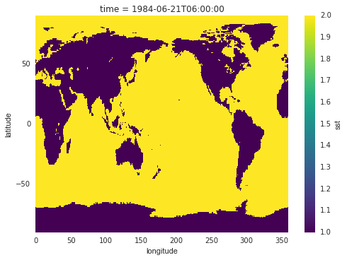
Buliding the mask:
Here we’ll use some lower-level numpy commands to build the mask (and we’ll need to import the numpy library). The mask number depends on whether the cells are finite or NaN:
import numpy as np
mask_ocean = 2 * np.ones((ds.dims['latitude'], ds.dims['longitude'])) * np.isfinite(ds.sst.isel(time=0))
mask_land = 1 * np.ones((ds.dims['latitude'], ds.dims['longitude'])) * np.isnan(ds.sst.isel(time=0))
mask_array = mask_ocean + mask_land
mask_array.plot()
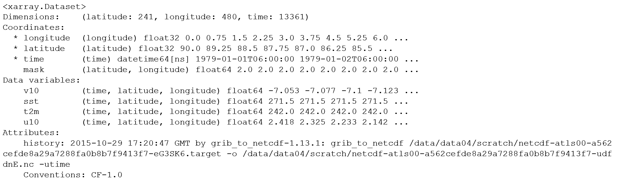
Mask as Coordinates
We can keep the mask as a separate array entity, or, if we are using it routinely, there are advantages to adding it as a coordinate to the DataArray:
ds.coords['mask'] = (('latitude', 'longitude'), mask_array)
ds
Now that the mask is integrated into the coordinates, we can easily apply the mask using where(). We can integrate this with statistical functions operating on the array:
with ProgressBar():
   ds['t2m'].mean('time').where(ds.mask == 1).plot()
Calculating a climate index
Climate scientists commonly calculate mean diferences in sea and land surface temperatures. These differences are used as an index and correlated to other earth surface processes, such as ecological change. Using the air temperature dataset, calculate the mean annual difference in SST and t2m?
Key Points
xarray provides tools for creating and analyzing masked data.